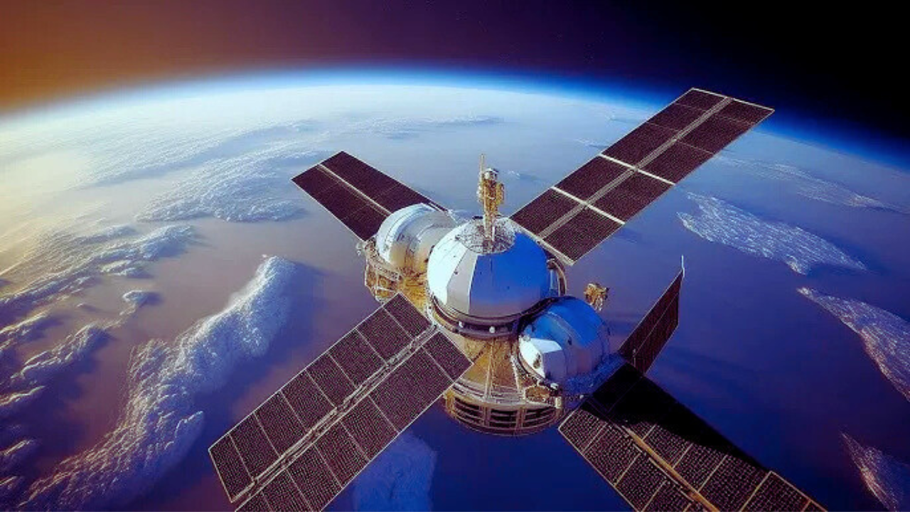
Remote sensing has transformed the way geographers study and analyze spatial data, providing a dynamic method for observing Earth’s surface from a distance. By utilizing technologies such as satellites, drones, and airborne sensors, remote sensing enables the collection of comprehensive data on various geographic features, including land cover, vegetation, climate change, and human impact. This technology has become indispensable in modern geography due to its capacity to gather real-time information over vast areas that would otherwise be challenging or impossible to monitor using traditional field methods.
Moreover, remote sensing plays a critical role in spatial analysis by offering an efficient and accurate way to monitor changes over time. Whether it’s tracking deforestation, urbanization, or shifts in agricultural practices, remote sensing helps to assess the rate and extent of environmental changes. This ability to conduct large-scale studies and obtain detailed insights into the Earth’s physical and human-made systems has made remote sensing a fundamental tool in geography, enhancing our ability to make informed decisions in areas like disaster management, land-use planning, and resource conservation.
Remote Sensing in Geography
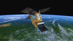
Remote sensing refers to the process of collecting information about an object or phenomenon without direct physical contact. In the field of geography, this technology typically involves the use of satellites, drones, or aircraft equipped with sensors to capture data about the Earth’s surface. These sensors rely on electromagnetic radiation, including visible light, radio waves, and microwaves, to detect and record various geographic features such as land cover, vegetation, bodies of water, and urban developments. This method provides geographers with an efficient way to study large areas, often in real-time, allowing for detailed observations of environmental and human-induced changes across vast landscapes.
The introduction of remote sensing technology has greatly transformed geographical research by enabling precise, large-scale data collection that was previously not feasible with traditional methods. The integration of remote sensing data with Geographic Information Systems (GIS) has further enhanced its utility, allowing for advanced spatial analysis and decision-making. This combination has proven crucial in many applications, such as urban planning, environmental monitoring, resource management, and disaster response, where accurate, up-to-date geographical data is vital for effective decision-making and long-term sustainability.
The Technology Behind Remote Sensing
At the core of remote sensing lies the use of electromagnetic radiation, including visible light, radio waves, and microwaves, to capture information about Earth’s surface. Sensors aboard satellites or aircraft detect this radiation as it interacts with various objects and phenomena on the ground. The reflected or emitted energy from these objects is recorded and converted into digital data, providing detailed images and measurements that reveal insights into geography. These sensors can be specifically designed to capture different wavelengths, allowing for the study of diverse features such as vegetation health, water bodies, urban infrastructure, and even atmospheric conditions.
Applications of Remote Sensing in Geography
Remote sensing has a wide range of applications in geography, playing a vital role in environmental monitoring, land use planning, and disaster management. By enabling the continuous observation of large areas, this technology assists in detecting and monitoring changes in ecosystems, urbanization, and agricultural patterns. For example, remote sensing can track deforestation, detect changes in wetlands, or identify areas affected by climate change. This invaluable tool is also used in agriculture to monitor crop health and productivity, providing farmers and researchers with crucial insights to make informed decisions.
Integration with Geographic Information Systems (GIS)
When combined with Geographic Information Systems (GIS), remote sensing data becomes even more powerful, enabling advanced spatial analysis and decision-making. GIS allows geographers to integrate remote sensing data with other types of spatial data, creating a comprehensive view of geographic phenomena. This combination helps professionals analyze relationships between different variables, such as urban development, environmental changes, and resource distribution. GIS enables the creation of layered maps and models, facilitating predictive analyses and aiding in long-term planning for cities, regions, and ecosystems.
Impact on Urban Planning and Development
The integration of remote sensing with urban planning has transformed how cities are designed, managed, and expanded. With access to real-time data on land use, transportation infrastructure, and population density, planners can make better-informed decisions regarding city development. Remote sensing helps identify areas that are rapidly urbanizing, allowing for the efficient allocation of resources and sustainable urban growth. Additionally, it assists in monitoring urban sprawl, which is essential for controlling unplanned growth and improving urban sustainability by identifying areas in need of infrastructure or environmental protection.
Environmental Monitoring and Conservation Efforts
Remote sensing plays an essential role in monitoring and conserving the environment. By regularly capturing data about forests, oceans, wetlands, and other natural environments, remote sensing technology allows for the assessment of environmental health over time. It provides valuable insights into the impacts of human activities, such as deforestation, pollution, and land degradation, on natural resources. Additionally, remote sensing helps track biodiversity and habitat loss, enabling conservation efforts to be more targeted and effective in preserving ecosystems for future generations.
Disaster Management and Response
In disaster management, remote sensing has proven to be an invaluable tool for assessing and responding to natural disasters such as hurricanes, floods, wildfires, and earthquakes. By capturing real-time data, remote sensing allows emergency responders to quickly assess the extent of damage, identify affected areas, and plan appropriate responses. It also helps in post-disaster recovery by providing up-to-date images of impacted regions, allowing for the evaluation of rebuilding needs and resource distribution. Additionally, remote sensing data can assist in early warning systems, enabling timely alerts that help reduce the impact of disasters on communities.
Future of Remote Sensing in Geography
The future of remote sensing in geography holds great promise, with technological advancements continuously improving the accuracy, resolution, and coverage of remote sensing data. With the rise of new satellite constellations, drones, and sensors capable of capturing more detailed data, remote sensing will continue to play an essential role in geography. The integration of artificial intelligence (AI) and machine learning with remote sensing will also enable more efficient processing and analysis of large datasets, allowing for more precise predictions and better decision-making. As a result, remote sensing will remain a vital tool for monitoring, understanding, and addressing global geographic challenges in the years to come.
Applications of Remote Sensing in Geography
Remote sensing technology has become indispensable in various geographical applications due to its ability to gather data from a distance, making it ideal for studying areas that are hard to access on the ground. It enables the monitoring and analysis of land use, vegetation health, water resources, and climate patterns. Key applications include mapping land use and land cover, tracking vegetation growth, assessing the impact of natural disasters, supporting urban planning, and managing water resources. Remote sensing is also essential for studying environmental changes such as deforestation and desertification, providing valuable data for informed decision-making and sustainable management.
| Application Area | Description | Technology Used | Impact/Benefit |
| Land Use and Land Cover Mapping | Identifying different land uses such as forests, agricultural land, urban areas, etc. | Satellite imagery, UAVs | Helps monitor land-use changes and supports sustainable land management. |
| Vegetation Analysis | Monitoring vegetation health, biodiversity, and forest cover. | Multispectral and hyperspectral imaging | Provides insights into plant health, biodiversity, and forest conservation. |
| Disaster Management | Analyzing the impact of natural disasters like floods, earthquakes, and wildfires. | Remote sensing satellites, drones | Aids in disaster response and resource allocation for recovery efforts. |
| Urban Planning and Development | Monitoring urban sprawl and planning infrastructure development. | High-resolution satellite imagery | Supports efficient urban planning and sustainable city growth. |
| Water Resources Management | Assessing water bodies, wetlands, and river systems. | RADAR, LIDAR, satellite imagery | Helps manage water distribution, quality, and conservation. |
| Climate and Environmental Change | Tracking deforestation, desertification, and changes in temperature or precipitation patterns. | Climate monitoring satellites, sensors | Monitors climate change and its environmental impacts, aiding in mitigation efforts. |
Remote Sensing Techniques in Geography
The techniques used in remote sensing vary based on the type of data being collected and the purpose of the analysis. The main categories of remote sensing include passive and active sensing.
- Passive Remote Sensing: This method relies on natural energy, typically sunlight, to capture data. Sensors record the energy reflected or emitted from the Earth’s surface. The most common example of passive remote sensing is satellite imagery captured in various wavelengths, such as visible light, infrared, and thermal infrared.
- Active Remote Sensing: Unlike passive systems, active sensors emit their energy (usually in the form of radar waves or lasers) to scan the Earth’s surface. The energy that returns to the sensor provides information about the surface. One of the most common examples is LiDAR (Light Detection and Ranging), which uses laser pulses to measure distances to the Earth’s surface.
Importance of Remote Sensing in Spatial Analysis
Spatial analysis involves examining the locations, attributes, and relationships of features on the Earth’s surface. Remote sensing provides geographers with the tools necessary to perform spatial analysis at various scales, from local to global levels. This is particularly useful for studying patterns and trends in geography, as well as for predictive modeling in fields like urban planning and environmental conservation.
- Identify and monitor changes in land use: By comparing satellite images over time, geographers can analyze how land use has changed, such as the expansion of urban areas or deforestation.
- Assess environmental changes: Remote sensing allows for monitoring environmental changes, such as shifts in vegetation health, land degradation, and climate-related phenomena.
- Monitor natural resources: Remote sensing helps track natural resources like forests, water bodies, and minerals, supporting sustainable resource management.
- Predict future trends: By analyzing historical data, remote sensing can be used to forecast future trends, such as the spread of urbanization or the impacts of climate change.
Remote Sensing Data Processing and Analysis
Once remote sensing data is collected through satellites, drones, or other sensors, it requires processing and analysis to derive valuable insights. The first step is data calibration, which ensures that the data accurately reflects the Earth’s surface by correcting for sensor errors or atmospheric conditions. Next, data preprocessing may include noise reduction and geometric corrections to align the images with geographical coordinates. Afterward, various analytical techniques like image classification, change detection, and feature extraction are applied to identify patterns and objects such as land cover, vegetation, or urban areas. The final stage involves interpreting the results to support decision-making in areas like environmental monitoring, urban planning, and disaster management.
Data Calibration
The data calibration process in remote sensing involves correcting raw satellite or sensor data to compensate for various factors such as sensor malfunctions, atmospheric distortions, or environmental conditions, ensuring that the collected data is consistent, accurate, and reliable for further analysis, which is crucial for making precise geographical assessments.
Preprocessing for Clarity
Data preprocessing is an essential step in remote sensing data analysis that helps improve the quality of the data. This process includes tasks like noise reduction, atmospheric correction, and geometric alignment of images, which ensures that the data is free from distortions and anomalies, making it suitable for detailed interpretation and subsequent analysis.
Image Classification
sensing, image classification refers to the method of categorizing pixels based on their spectral reflectance properties, essentially dividing the image into distinct classes like vegetation, water, urban areas, or bare soil. This step is instrumental in mapping land use and cover types, as well as in environmental monitoring, enabling the identification of patterns and land transformations.
Change Detection
Change detection is a critical analysis technique in remote sensing that involves comparing satellite images taken at different times to identify and track changes in the landscape. This process is vital for monitoring environmental shifts, such as the effects of deforestation, urban expansion, or agricultural changes, offering invaluable insights into ongoing transformations and their causes.
Feature Extraction
Feature extraction focuses on identifying key elements or physical features within remote sensing images, such as bodies of water, roads, forests, and urban structures. This is a crucial step in transforming raw image data into structured, usable geographic information that can be applied in areas like infrastructure planning, natural resource management, and environmental protection.
Data Interpretation
Data interpretation is the final, crucial stage in remote sensing where the processed data is analyzed to extract meaningful insights. Experts examine the detected features, patterns, and changes to provide actionable recommendations that support various decision-making processes, from disaster management and urban planning to environmental conservation and policy formulation.
| Step in Data Processing | Description |
| Preprocessing | Correcting atmospheric and geometric errors. |
| Data Classification | Categorizing data into features like vegetation, water, etc. |
| Image Analysis | Enhancing data clarity for better feature identification. |
| Spatial Modeling | Predicting trends and analyzing the distribution of features. |
Challenges in Remote Sensing for Geography
- Data Interpretation: Remote sensing data can be complex and requires specialized knowledge to interpret accurately. The accuracy of interpretations depends on the resolution of the data and the classification methods used.
- Atmospheric Interference: Atmospheric conditions, such as clouds, can distort satellite imagery and affect the quality of remote sensing data.
- Data Integration: Integrating remote sensing data with other data sources, such as ground-truth data or historical records, can be challenging and requires careful calibration and alignment.
- High Costs: The use of advanced remote sensing technologies, particularly high-resolution satellite imagery or LiDAR, can be costly for many organizations and researchers.
Future of Remote Sensing in Geography
- Higher Resolution Imagery: With the continuous advancements in satellite technology, we are poised to see significant improvements in imagery resolution, allowing for the collection of much finer details. This will result in enhanced accuracy for mapping geographical features such as forests, water bodies, and urban infrastructure. The ability to capture sharper images will lead to better monitoring of environmental changes, land-use patterns, and the management of natural resources, ultimately supporting more informed decision-making in geography.
- Real-Time Monitoring: As sensor technology progresses and data processing capabilities improve, the ability to monitor geographical features in real time will become a reality. This shift will allow geographers and planners to observe and track dynamic environmental processes, such as the rapid spread of wildfires or the effects of climate change, as they unfold. Real-time data collection will significantly speed up the response times for disaster management, providing critical information for immediate action and facilitating better planning for future events.
- Integration with Advanced Technologies: The future of remote sensing will see the seamless integration of artificial intelligence, big data analytics, and drones, further enhancing the precision and scope of geographical data analysis. AI and machine learning algorithms will enable automated classification and interpretation of vast datasets, while drones will provide on-the-ground, high-resolution imagery that complements satellite data. The combination of these technologies will lead to smarter, more efficient applications in fields such as urban development, environmental monitoring, and resource management, opening new possibilities for geographical research and decision-making.
Wrapping Up
Remote sensing has become an indispensable tool in the field of geography, revolutionizing the way spatial data is collected, analyzed, and interpreted. Its ability to provide high-resolution, real-time imagery across large areas allows geographers to gain deeper insights into the Earth’s surface, enabling more informed decision-making. This technology has significantly advanced various fields, such as environmental monitoring, disaster management, and land use planning, providing valuable information that supports sustainability efforts and enhances urban development strategies.
As technology continues to improve, remote sensing will only become more influential in shaping our understanding of geographic patterns and phenomena. With advancements in sensor capabilities, data processing, and integration with other technologies like AI and drones, remote sensing will offer even more precise and timely insights. These improvements will empower researchers, policymakers, and environmentalists to address global challenges such as climate change, resource management, and urbanization more effectively, ultimately fostering a more sustainable and well-managed planet.
FAQs
What is remote sensing in geography?
Remote sensing in geography involves collecting data about the Earth’s surface using satellite or aerial sensors. It allows geographers to observe and analyze geographic features without direct contact, making it invaluable for spatial analysis and monitoring large areas.
How does remote sensing help in land use mapping?
Remote sensing is used to capture images of the Earth’s surface at different wavelengths, which are analyzed to identify various land use categories like forests, urban areas, water bodies, and agricultural land. This information is crucial for urban planning and environmental management.
What are the benefits of using remote sensing for environmental monitoring?
Remote sensing enables geographers to monitor changes in the environment over time, such as deforestation, desertification, and changes in vegetation health. This helps in understanding environmental trends and making informed decisions for conservation efforts.
What challenges are faced in using remote sensing for geographical analysis?
Some challenges include data interpretation, atmospheric interference, data integration with other sources, and the high cost of advanced satellite imagery. These challenges require skilled professionals and specialized software for effective use.
Can remote sensing be used in disaster management?
Yes, remote sensing is widely used in disaster management to monitor natural disasters like floods, wildfires, and earthquakes. It provides real-time data, helping emergency responders assess damage and plan recovery efforts.
How does remote sensing aid in urban planning?
Remote sensing helps urban planners monitor the growth and expansion of cities, identify land use patterns, and plan infrastructure projects. It provides up-to-date data on urban sprawl, helping make better decisions for sustainable development.
What is the future of remote sensing in geography?
The future of remote sensing in geography looks promising, with advancements in satellite technology, real-time monitoring capabilities, and the integration of AI and drones. These developments will further enhance remote sensing’s role in solving geographical challenges.
Related posts:
 Agricultural Geography: The Study of Agriculture’s Role in Geography and Environment
 Best Father of Geography: Life, Legacy & Global Influence in 2025
 Pmf IAS Geography Notes for Smart UPSC Prep
 Universe In Hindi | ब्रह्मांड क्या है और कैसे जन्म हुआ?
 Galaxy in Hindi | आकाशगंगा क्या है पूरी जानकारी
 नदी कीसे कहते है, बिशेषताई, कार्य, QnA | River in Hindi
 Poonam Pandey: A Biography of the Bold and Controversial Indian Model
 Geopolitical Boundaries: Shaping Global Relations in 2025